Kiev topographic map
You can find on this page the Kiev topographic map to print and to download in PDF. The Kiev elevation map present the topography, river and relief of Kiev in Ukraine.
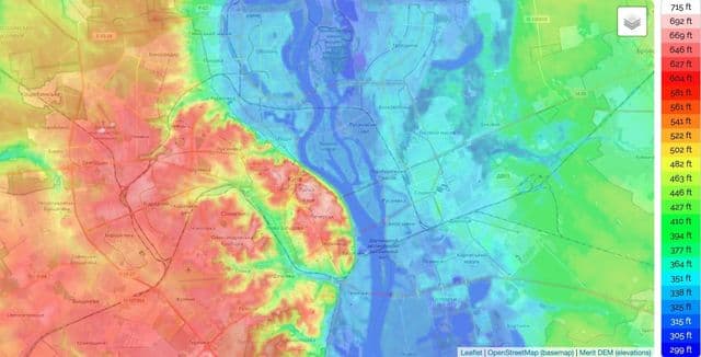
Kiev elevation map
The Kiev topographic map shows elevation, hills and landforms in Kiev. This elevation map of Kiev will allow you to know topography, river and relief of Kiev in Ukraine. The Kiev topographic map is downloadable in PDF, printable and free.
The Elevation map of Kiev displays range of elevation with different colours. The elevation map of Kiev is generated using elevation data from NASA 90m resolution SRTM data. The maps also provides idea of topography and contour of Kiev. Coordinates : 50.29003 30.36414 50.61003 30.68414. Minimum elevation : 86 m. Maximum elevation : 213 m. Average elevation : 132 m.